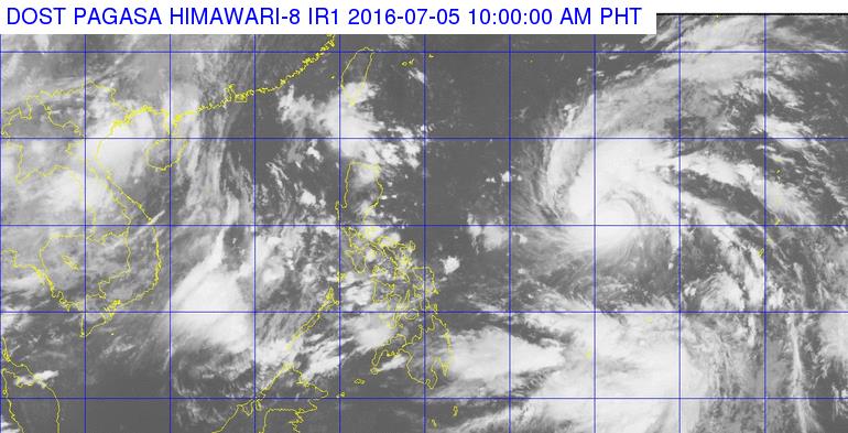
The center of tropical storm “Nepartak” (local name: Butchoy) was eyed Tuesday morning outside the Philippine Area of Responsibility (PAR) near Virac, Catanduanes.
State weather bureau Philippine Atmospheric, Geophysical and Astronomical Services Administration (PAGASA) said “Nepartak” is not expected to directly hit any province but would enhance the southwest monsoon.
It has a maximum sustained winds of 105 kph near the center, and gustiness of up to 135 kph. It is expected to move northwest to Taiwan at 30 kph.
The southwest monsoon is currently affecting southern Luzon, Visayas and Mindanao. The regions of Calabarzon, Mimaropa, western Visayas, Davao and the provinces of Zambales and Bataan may experience cloudy skies with light to moderate rains and thunderstorms.
Over Metro Manila and the rest of the archipelago, partly cloudy to cloudy skies with isolated rainshowers or thunderstorms will prevail.
Moderate to occasionally strong winds will blow from southwest over the eastern part of Mindanao. Coastal waters along this area will be moderate to rough.
Light to moderate winds blowing from the southwest will prevail over Palawan, Visayas and the rest of Mindanao, and from south to southeast over the rest of Luzon with slight to moderate seas. (PNA)