Communities in northern Luzon risk experiencing the brunt of the typhoon with the international name ‘Haima’, which could intensify into a super typhoon and make landfall there this week, the state weather bureau said.
“We are not discounting such possibility so communities there must already prepare accordingly,” said weather forecaster Meno Mendoza of the Philippine Atmospheric, Geophysical and Astronomical Services Administration (PAGASA).
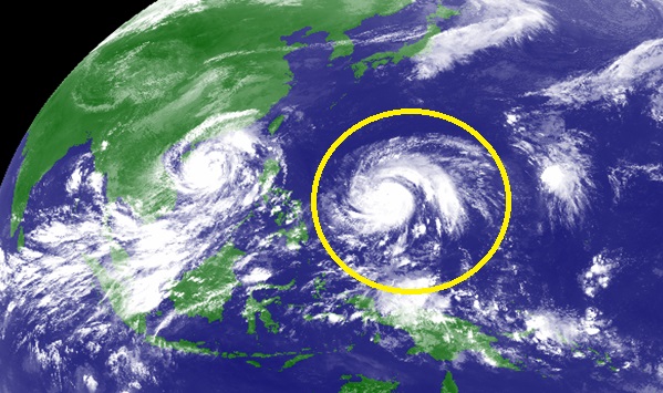
He noted that ‘Haima’ is still outside the Philippine Area of Responsibility (PAR) but is heading towards the country, moving over Pacific waters where it continues to draw energy needed to intensify.
Citing the latest available data, Mendoza said ‘Haima’ will enter PAR on Monday afternoon, move northwestwards and make landfall this Thursday in northern Luzon’s Cagayan province.
‘Haima’ is forecast to move across the northern section of northern Luzon and head towards the Ilocos area, he continued.
The onslaught of ‘Haima’ will likely affect the country’s northernmost Batanes province group of islands and Babuyan Islands as well, he noted.
Once inside PAR, ‘Haima’ will assume its local name, ‘Lawin’.
“Aside from heavy rainfall, ‘Haima’ will likely fan storm surges in Cagayan’s eastern coast,” Mendoza said.
Winds of 220 kph or more are also possible if ‘Haima’ intensifies into a super typhoon.
Landslides are likely as well since soil in some northern Luzon areas might be saturated already due to the heavy rainfall dumped by Typhoon ‘Karen’ (international name ‘Sarika’) there last week.
‘Karen’ exited PAR at about 12 a.m. Monday, said PAGASA.
In its tropical cyclone advisory 3 released Monday, PAGASA located ‘Haima’ at 1,615 km. east of the Visayas as of 10 a.m. Monday.
‘Haima’ intensified as it packed maximum sustained winds of up to 150 kph and gustiness of up to 185 kph, said PAGASA.
The bureau forecast ‘Haima’ to move west-northwest at a faster 22 kph.
Mendoza said there is a 100 percent chance for ‘Haima’ to enter PAR.
High pressure building up over the Chinese mainland will prevent ‘Haima’ from veering northeast towards Japan, so this typhoon will head towards the Philippines instead, he noted.
“Historical records show tropical cyclones in the Pacific head towards and (make) landfall in the Philippines during this time of the year,” he added. (PNA)