A potentially potent storm seen to intensify into a severe tropical storm and even a typhoon when it enters the Philippine Area of Responsibility late on Tuesday has been projected to directly hit Bohol.
Based on the forecast track of the Philippine Atmospheric, Geophysical and Astronomical Services Administration (PAGASA) released at 11 p.m. on Monday, the cyclone could make landfall in Bohol between Thursday and Friday.
Once it enters PAR, the weather disturbance which was still a tropical storm as of Monday night will be given the local name “Odette.”
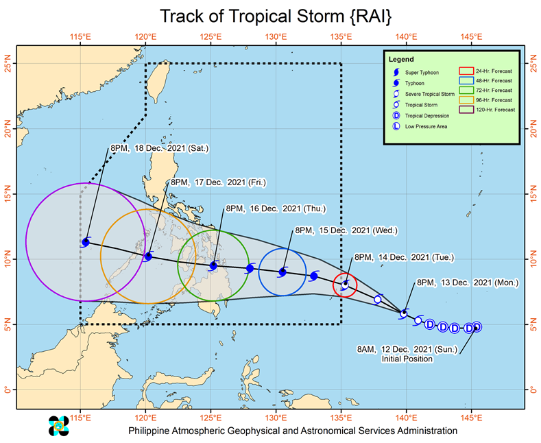
According to PAGASA’s latest bulletin, Tropical Storm “Rai” (international name) could further intensify into a typhoon before making its first landfall and heading towards Bohol.
“While inside the PAR, favorable atmospheric conditions will favor sustained intensification prior to landfall. This tropical cyclone is forecast to reach typhoon category on Wednesday,” said PAGASA.
“There is a high likelihood that Tropical Cyclone Wind Signals will be hoisted for Visayas, large portions of Mindanao, and several provinces in Southern Luzon due to the threat of strong to typhoon-force winds associated with the passage of “RAI,” it added.
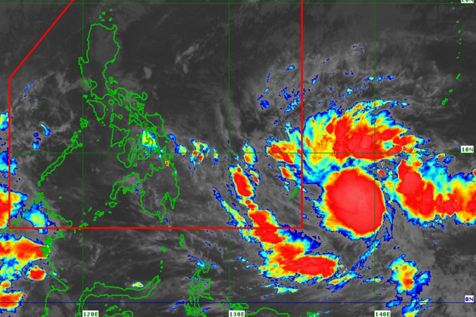
The state weather bureau added that the center of the Tropical Storm “Rai” (international name) was estimated, based on all available data, to be located 1,585 kilometers east of Mindanao.
The storm was packing maximum sustained winds of 65 km/h near the center and gustiness up to 80 km/h.
It was moving west northwestward at 20 km/h.